Contact: +91 99725 24322 |
Menu
Menu
Quick summary: Misinterpreting satellite data can cost your business EUDR compliance. Learn the most common forest data misconceptions, how to avoid false positives and false negatives, and how to stay audit-ready with precision mapping.

“One wrong pixel can cost your shipment.” In the race to meet EUDR requirements, many agribusinesses are putting their trust in static forest cover maps or generic satellite alerts — believing that a green patch means “safe” and a cleared spot means “risky.” This is where EUDR forest data misconceptions become dangerous.
But here’s the truth: the biggest threat to your compliance may not be deforestation — it may be the misinterpretation of forest data. Regulators, buyers, and certifiers expect precise, plot-level proof that sourcing areas are deforestation-free post-2020 — not just rough estimates or third-party overlays. Yet, companies relying on outdated maps, oversimplified NDVI models, or low-resolution imagery are being blindsided by false positives, audit failures, and shipment holds — even when their farms are compliant.
In this blog, we’ll break down what EUDR actually requires when it comes to forest data, why common assumptions can cost you, and how to build a smarter, field-aligned approach to risk detection and reporting that your auditors — and your EU buyers — can trust.
Key Takeaways
Under the EUDR, it’s not just about showing green areas on a map — it’s about proving, with confidence, that no part of your supply chain contributed to deforestation after December 31, 2020.
That means your forest data has to be precise, plot-specific, and verifiable — not vague or broad.
So what exactly does the EU expect from you?
At the core of EUDR is plot-level traceability.
That means you need to provide exact geolocation coordinates (polygon boundaries, not just a GPS point) for every farm or sourcing area in your supply chain.
Why?
Because this is how authorities verify that the land in question wasn’t deforested after the cut-off date.
If your polygons are off by even a few meters — and cross into a cleared area — you could be flagged.
Many companies make the mistake of assuming any tree cover equals a forest, or that any land use change is automatically deforestation.
But EUDR has specific definitions and understanding them is crucial.
Under EUDR, your job is to prove that your sourcing areas were forest-free — or not deforested — after Dec 31, 2020.
That means you must show:
Think of it this way:
You’re not just declaring your product is deforestation-free.
You’re building a case that can pass audit, customs, or buyer scrutiny — backed by data, timestamps, and geo-proof.
Your team (or consultants) may already be using tools like:
But here’s the catch:
These tools don’t interpret EUDR compliance for you.
They show raw data — but it’s your responsibility to overlay, analyze, and interpret that data against your actual sourcing plots.
So while they’re powerful, they require:
This is where most suppliers, cooperatives, and mid-sized agri-exporters get stuck.
They have the tools — but not the clarity or workflow to use them confidently.
If your sourcing polygons are inaccurate, your forest definitions are off, or your proof is weak — your shipments can be flagged, delayed, or rejected.
EUDR forest data misconceptions don’t just cost time. They cost markets.
This is why forward-thinking agribusinesses are investing in traceability and DMRV tools that bring together field data, satellite validation, and compliance reporting — all in one place.
When it comes to EUDR forest data checks, the real danger isn’t always deforestation itself.
It’s false positives — cases where your farms or plots are flagged incorrectly because the satellite data is misunderstood or oversimplified.
And make no mistake:
One false positive can delay your shipment, trigger audits, or even risk losing a buyer’s trust.
Here are five common misconceptions you absolutely need to unlearn to stay ahead:
Just because satellite imagery shows a sudden loss of tree cover doesn’t mean it’s permanent deforestation.
…can all trigger canopy “loss” on a satellite view without any true land-use conversion happening.
Smart compliance means distinguishing between real deforestation and legitimate, reversible land use changes — and documenting them with field-level proof when needed.
This is one of the biggest hidden risks — and the source of endless confusion.
Can agroforestry be mistaken for forest in EUDR checks?
Yes, easily — if you’re not careful.
Agroforestry systems (like cocoa, coffee, or timber intercropping with native trees) often appear as dense green canopy on satellite imagery.
To an algorithm or a basic land classification tool, these areas might look exactly like untouched natural forests — even though they’re actively farmed, sustainably managed, and EUDR-compliant.
Without proper plot-level documentation, your agroforestry farms could be wrongly flagged as “forest land conversion” risks.
Smart compliance means tagging and classifying agroforestry plots clearly during onboarding — and having ground-truth evidence (like farmer profiles, input logs, land history) ready when needed.
Satellite images aren’t perfect.
Pixels near the edges of farms — especially in high-resolution maps — can blur or misclassify land use.
A farm that borders a genuine forest might have 5-10 meters of pixel “bleed,” making it appear non-compliant even though the actual farming activity is clean.
Smart compliance means validating edge cases carefully — using polygon precision, high-resolution imagery and smart risk flagging to avoid unnecessary self-penalization.
Many companies panic when they get an alert from satellite tools like GFC or Global Forest Watch.
“We got an alert! Are we non-compliant?”
Not necessarily.
Most forest loss alerts are generated automatically, based on pixel-level changes — not based on legal land use definitions.
Smart compliance means investigating alerts carefully, not assuming guilt by notification.
In fear of compliance risk, many companies over-correct:
This not only increases operational costs — it also damages supplier relationships and shrinks the sourcing pool needlessly.
Smart compliance means using smart risk scoring, real verification, and confident, data-backed decision-making — instead of blanket exclusions.
EUDR success isn’t just about spotting deforestation. It’s about avoiding false positives — and building a smarter, field-verified, farm-specific risk management approach.
In short:
And platforms like TraceX are designed exactly for this — helping companies differentiate real risk from noise, protect compliant suppliers, and safeguard shipments.
When it comes to EUDR, everyone talks about false positives — farms wrongly flagged for deforestation.
But there’s an even bigger, more dangerous blind spot that’s much harder to catch: false negatives.
False negatives happen when real deforestation slips through your checks unnoticed — and that’s when the real compliance disasters start.
You can do everything right in good faith, but if your verification system misses even a small land-use violation, the consequences under EUDR are heavy:
Many companies breathe easy when their satellite platform shows no immediate deforestation alerts.
But alerts are just the first line of defense — not the full story.
Most satellite tools are optimized for large, obvious forest loss — not subtle or gradual land-use changes.
Missing an alert doesn’t guarantee your sourcing area is clean.
Smart compliance means combining alerts with deeper plot-level verification, historical land-use analysis, and risk-based sampling.
Deforestation isn’t always about clear-cutting an entire forest.
Sometimes it’s:
These practices often don’t show up in traditional forest loss alerts — but they can still trigger non-compliance under EUDR if the land no longer qualifies as ‘forest’ by legal definitions.
Smart compliance means detecting and documenting even partial land-use changes, not just full clearances.
Not all satellite imagery is created equal.
Meaning:
You might not see a violation until it’s too late — especially in mixed farming landscapes where clearing happens in patches.
Smart compliance means supplementing free or coarse imagery with higher-resolution commercial imagery when needed.
EUDR requires you to prove that no deforestation happened after December 31, 2020.
The risk?
Smart compliance means ongoing monitoring — not one-time mapping — and updating farm profiles when any land-use changes occur.
Finally, the biggest trap:
Putting all your trust in one satellite tool or risk report.
No single data source is foolproof.
Smart compliance means combining:
In EUDR audits, layered, cross-verified evidence wins — not single-source assumptions.

With TraceX:
Negligible risk means you must reasonably ensure — through documented due diligence — that deforestation has not occurred on the plots you source from after Dec 31, 2020.
The EU understands:
What they expect is structured, defensible, proactive compliance — not an unrealistic guarantee.
Smart EUDR compliance starts with getting your basics right:
Sometimes, digital tools alone aren’t enough.
When should you trigger ground verification?
Ground verification can include:
Smart compliance means using ground checks selectively — targeted where digital risk flags arise, not blanket across all farms.
EUDR compliance isn’t about eliminating all risk.
It’s about proving you knew the risks, acted responsibly, documented proactively, and verified intelligently.
If you can show:
…then you’ve done what EUDR demands — and you stand on strong legal and commercial ground.
When it comes to EUDR compliance, the real challenge isn’t just detecting deforestation risks —
It’s knowing when you’re seeing the right risks, and acting before they cost you.
False positives (flagging clean farms) waste time, shrink your sourcing pool, and scare buyers unnecessarily.
False negatives (missing real violations) lead to customs rejections, fines, and brand damage.

Here’s how TraceX EUDR Platform helps you strike that balance:

Most platforms give you satellite monitoring or field tools — rarely both.
TraceX unites them seamlessly:
One-time snapshots aren’t enough for EUDR.
You need to show that your farms:
TraceX enables dynamic historical comparisons:

Traditional tools drown you in raw alerts.
They expect you to figure out:
TraceX does the heavy lifting for you:
Ready to take the friction out of EUDR compliance?
See how a global tire brand streamlined natural rubber traceability, risk checks, and EU due diligence reporting — all with TraceX.
Read the full case study
Not all trees are forests under EUDR.
Misclassifying agroforestry, plantations, or degraded lands could trigger false positives or false negatives.
TraceX uses deeper forest type intelligence:
The path to EUDR compliance isn’t about chasing perfect data — it’s about building smart, defensible systems that minimize risk, maximize trust, and keep your supply chain resilient.
By understanding and avoiding both false positives and false negatives, food and agribusinesses can protect their shipments, prove their impact, and grow sustainably in the new regulated economy.
Tools like TraceX help you move from guesswork to precision, from fear to confidence — giving you the power to monitor, verify, and prove deforestation-free sourcing with credibility that stands up to buyer scrutiny and regulatory audits.
If false positives (such as temporary canopy loss or agroforestry misclassification) trigger alerts, it can unnecessarily delay your shipment, trigger additional audits, and complicate your due diligence reporting.
That’s why it’s crucial to combine satellite alerts with field data verification and risk scoring — so you can prove compliance confidently without over-penalizing clean farms.
Yes. Under EUDR, ignorance is not a defense.
If deforestation or illegal land-use changes after December 2020 are later discovered in your supply chain — even if missed initially — your company can face fines, shipment rejections, and brand reputation damage.
Continuous monitoring, historical land-use checks, and multi-source validation are critical to minimize this hidden risk.
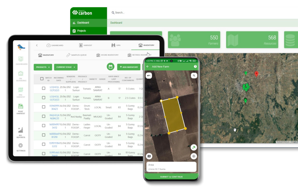
TraceX combines real-time satellite imagery, offline-enabled field data collection, risk scoring dashboards, and ground verification triggers.
This integrated approach ensures that your supply chain monitoring is not only reactive but proactive — catching real risks while protecting compliant farms from false alarms.
TraceX helps you build audit-ready documentation and maintain buyer trust, without drowning in unnecessary alerts or compliance panic.
