How to Conduct a Deforestation Risk Assessment Under EUDR 

Published
, 19 minute read

Quick summary: Learn how to conduct a comprehensive deforestation risk assessment under EUDR. Understand the key steps, data sources, and best practices for ensuring compliance with the EU Deforestation Regulation. Safeguard your supply chain with actionable insights for deforestation-free sourcing and sustainability.

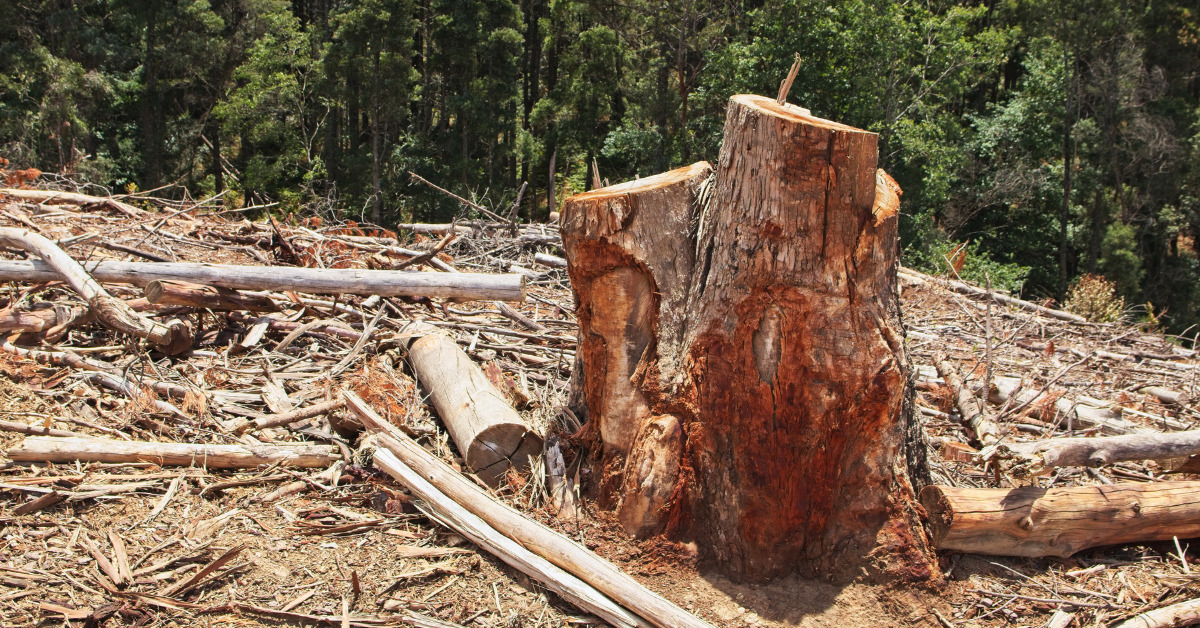
Under the EU Deforestation Regulation (EUDR), companies must prove that their products are not linked to deforestation occurring after December 31, 2020. This requirement makes deforestation risk assessment a core compliance step. Without it, operators cannot lawfully place goods like coffee, cocoa, soy, or rubber on the EU market. 

Under the EU Deforestation Regulation (EUDR), exporters and operators must assess deforestation risk for each farm plot by verifying land-use change since 2020, checking proximity to protected areas, and scoring risk using satellite data and legal documents. Tools like Hansen GFC, Sentinel-2, and traceability platforms streamline the process and reduce compliance errors. 

The consequences of missing or inaccurate assessments are serious: rejected shipments, financial penalties, or even bans from the EU. That’s why exporters, producer companies, and especially “first placers” (those introducing products into the EU) must implement robust, verifiable risk assessment methods—using satellite data, geolocation files, and documented land legality. 

Key Takeaways 

  • A Deforestation Risk Assessment under EUDR evaluates whether materials sourced from specific regions comply with deforestation-free standards.  
  • Key steps include mapping farm plots correctly, using satellite data for deforestation checks, and assessing proximity to protected areas. 
  •  Legal risk is assessed beyond land titles, considering land use compliance and ownership rights.  
  • Deforestation risk scoring helps prioritize high-risk areas, and mitigation is required when risks are identified.  
  • TraceX’s platform simplifies this process with automated data collection, real-time monitoring, and risk assessment tools, ensuring EUDR compliance through streamlined workflows and transparency. 

Discover how a leading tire company successfully future-proofed its rubber exports by navigating EUDR compliance. Learn how TraceX’s solutions streamlined their traceability processes, ensured deforestation-free sourcing, and kept them ahead of evolving regulations. 

Read the full case study on how they achieved seamless EUDR compliance and transformed their supply chain for long-term sustainability. 

What is a Deforestation Risk Assessment Under EUDR? 

A deforestation risk assessment under the EU Deforestation Regulation (EUDR – Regulation (EU) 2023/1115) is the process by which operators and traders evaluate whether a commodity was produced on land that experienced deforestation or forest degradation after 31 December 2020. The purpose is to ensure that only deforestation-free goods enter the EU market, aligning with global climate and biodiversity goals. 

What makes EUDR different is that it doesn’t just require reporting—it requires proof. Operators must demonstrate that the risk of deforestation is “not negligible,” a phrase that deliberately sets a low tolerance threshold. This means that even minimal forest loss—if unaccounted for—can lead to non-compliance. 

Unlike general sustainability audits, EUDR risk assessments are plot-specific, time-stamped, and require scientific evidence such as geolocation files, satellite data (e.g., Hansen GFC, Sentinel-2), and verification of land legality. These assessments feed directly into the Due Diligence Statement (DDS) submitted through the EU TRACES portal, serving as the factual backbone for compliance claims. 

In short, deforestation risk assessment under EUDR is not just a formality—it’s a regulatory gatekeeper. Without it, there is no compliant DDS, and therefore, no access to the EU market. Unlike traditional sustainability claims that are broad and voluntary, the EUDR assessment is granular, mandatory, and auditable—down to the GPS point or polygon. 

A risk assessment isn’t just about forests—it’s about trade access. If your risk methodology is weak, your product’s market access is fragile. 

This positions the deforestation risk assessment not as a paperwork task, but as a strategic differentiator. Companies that treat it seriously build resilient supply chains and win trust. Those that don’t? Risk blocked shipments, regulatory scrutiny, and buyer loss. 

Stay Ahead of EUDR Compliance! 

Unlock the full potential of your supply chain with expert insights on EUDR compliance risk assessments and comprehensive due diligence guides. Learn how to navigate deforestation risk and ensure sustainable sourcing across your entire supply chain. 

Explore our latest blogs

How Do You Map Farm Plots Correctly for EUDR Compliance? 

To comply with EUDR, use point coordinates for small plots under 4 hectares and polygons for larger or high-risk areas. Format the data in valid GeoJSON files with accurate geometry—no overlaps, gaps, or open shapes. Proper mapping ensures traceability, passes EU validation checks, and anchors your Due Diligence Statement (DDS) to verified land. 

Under EUDR, every farm plot that contributes to a regulated commodity must be mapped with verifiable geolocation data—either as a point (for small plots) or a polygon (for larger or high-risk areas). This step isn’t just administrative; it’s the foundation of your entire due diligence process. 

When to Use Point vs. Polygon 

  • Point: Use for plots <4 hectares or where full boundaries are inaccessible. Must include precise latitude and longitude—preferably with a timestamp and plot size. 
  • Polygon: Required for larger plots, collective farms, or regions near protected areas or forest frontiers. Must define actual plot boundaries. 

A polygon gives regulators and buyers confidence that you know exactly where your product comes from—and that no forest was lost to produce it. 

Formatting GeoJSONs for Compliance 

  • Use standard GeoJSON format with validated coordinates 
  • Include metadata such as plot ID, crop type, and collection method 
  • Ensure files follow EU TRACES compatibility (no malformed structures) 

Think of GeoJSON as your farm’s digital passport—if it’s incomplete or corrupted, your product could be denied entry. 

Geometry Integrity Rules (And Why They Matter) 

EUDR expects geometries that are: 

  • Closed (for polygons) 
  • Free of self-intersections or “spikes” 
  • Accurate to the plot’s real shape (not approximate buffers unless justified) 

Non-compliant geometry can cause: 

  • DDS submission errors 
  • Audit flags or delays at customs 
  • Perception of data manipulation 

Common Challenges Faced by Producers 

  • Limited access to GPS tools in remote or low-connectivity regions 
  • Field staff errors while collecting coordinates 
  • Lack of trained personnel to validate geometry formats 
  • Fragmented supply chains where farmer plots are not well-defined 

Solution Insight 

Platforms like TraceX simplify this process with: 

  • Mobile apps that collect point/polygon data offline 
  • Built-in geometry validation 
  • Direct export to EUDR-compliant GeoJSON format 
  • Support for pseudo-polygon buffers when full mapping isn’t feasible 

How to Run Satellite-Based Deforestation Checks for EUDR Compliance 

To meet the EU Deforestation Regulation (EUDR) requirements, operators must verify that no deforestation occurred on sourcing plots after 31 December 2020. This verification hinges on interpreting satellite-based forest-change data effectively. However, understanding what the data shows—and doesn’t—is just as critical as having access to it. 

Recommended Datasets 

  1. Hansen Global Forest Change (Tree Cover Loss – TCL) 
  • Best for detecting year-over-year tree canopy loss (≥30% canopy cover). 
  • Covers global data from 2000 onwards but doesn’t distinguish natural vs. human-driven loss. 
  • Customers often misinterpret “loss” as deforestation when it could be thinning, storm damage, or replanting. 
  1. Sentinel-2 (10m resolution imagery) 
  • Higher resolution imagery ideal for zooming into smallholder plots. 
  • Useful for visual confirmation of land use, boundary encroachment, or regrowth. 
  1. Global Forest Watch (GFW) 
  • Optional overlay for deforestation alerts, fire risk, and logging permits. 
  • Often used as a first-look screening tool but lacks the resolution for official EUDR validation. 

2020 Cutoff: What to Check 

EUDR requires proof that no conversion of forest to agriculture occurred after Dec 31, 2020. When reviewing satellite data: 

  • Compare imagery from late 2020 to the latest available. 
  • Zoom in on newly cleared areas inside or near plot polygons. 
  • Overlay historical land-use layers to confirm pre-2020 cultivation. 

Interpreting Tree Cover Loss: Key Insights 

  • Tree cover loss ≠ deforestation by default: Hansen TCL flags a change in canopy, but not the cause. 
  • Natural disturbance (e.g., storm, fire, pest) needs ground verification or drone footage to prove it’s not land conversion. 
  • Regrowth patterns are essential: If a canopy has recovered post-loss, include NDVI/NDWI trends in your documentation. 
  • Seasonal variability (especially in agroforestry or dryland systems) may look like loss in one season and regrowth in another—leading to false positives. 

Why Deforestation Checks Are Not Plug-and-Play 

EUDR doesn’t just require satellite evidence—it demands interpretation in legal and agronomic context. Many exporters rely solely on alerts from tools like GFW or automated DDS platforms, which can over-flag plots and lead to unnecessary exclusions. Ground truthing, field photos, and farmer interviews remain indispensable to distinguish between real risk and non-critical change. 

Common Customer Challenges 

  • False positives from tree pruning, replanting, or agroforestry cycles. 
  • Over-reliance on buffer zones that penalize compliant farms near deforested areas. 
  • Lack of resolution in public datasets for fragmented, smallholder plots. 
  • Difficulty in interpreting canopy gaps vs. full land-use conversion. 
  • Inconsistent polygon geometry that doesn’t match satellite overlays. 

Always pair remote sensing with field-level intelligence. Use satellite datasets to flag risk, not finalize decisions. Then document your findings with clear visual evidence and attach to your Due Diligence Statement (DDS). This ensures traceability, defensibility—and compliance. 

How to Check Proximity to Protected Areas: A Key Step in EUDR Risk Assessment 

Under the EU Deforestation Regulation (EUDR), it’s not enough to prove that a sourcing plot is deforestation-free—you must also assess contextual risk, especially when plots are near protected areas or ecologically sensitive zones. This includes proximity to sites listed in the World Database on Protected Areas (WDPA) and Key Biodiversity Areas (KBAs). While not a direct trigger for non-compliance, closeness to these zones can elevate scrutiny during audits or DDS evaluations. 

Tools & Layers to Use 

  1. WDPA (World Database on Protected Areas) 
  • Global dataset maintained by UNEP-WCMC. 
  • Contains national parks, community reserves, forest sanctuaries, and more. 
  • Often used as a regulatory benchmark—but definitions vary between countries. 
  1. KBA (Key Biodiversity Areas) 
  • Scientifically identified habitats critical for globally important species. 
  • Not legally protected in all jurisdictions, but carry weight in EU risk logic. 
  • Can intersect with working farms in high-biodiversity countries. 

Why Proximity Matters 

  • Being inside or close to these zones raises red flags—even if no forest loss is detected. 
  • EU authorities may request additional documentation or conduct deeper checks on land legality and community impact. 
  • The risk of future land conflict or ecological degradation is seen as higher, especially if the buffer area has been previously contested. 

Role of Buffer Zones in Contextual Risk 

  • Most EUDR-compliant platforms apply a conservative buffer—usually 100–300 meters—around WDPA and KBA zones. 
  • If your plot falls within this zone, it may still be compliant, but the operator must justify inclusion. 
  • Buffer logic helps account for spillover impacts, illegal encroachment risks, or informal settlements near protected land. 

Instead of simply excluding plots near protected areas, engage proactively: 

  • Work with local forestry departments to validate land status. 
  • Conduct a community-level impact assessment or biodiversity check. 
  • Use agentic AI or GIS tools to generate compliance buffers dynamically, so you can justify sourcing even in edge-case plots. 

Common Challenges for Exporters 

  • Inaccurate or outdated WDPA boundaries, especially in fast-changing landscapes. 
  • Overlap with traditional farming zones that were retroactively designated as protected without proper community consultation. 
  • Conflicting data between local land-use maps and global datasets. 
  • Lack of documentation to prove legal farming rights near sensitive zones. 

Best Practice 

Always overlay WDPA and KBA boundaries on your geolocation maps before DDS submission. If a plot lies near or within a buffer zone, flag it for enhanced due diligence: gather land titles, community agreements, and high-resolution imagery to demonstrate negligible risk. This not only ensures compliance but builds a stronger case for ethical sourcing in biodiversity-rich regions. 

How to Assess Legal Risk Under EUDR: Beyond Land Titles 

One of the core pillars of EUDR compliance is proving that products come from land where production is legally permitted. This requires not just deforestation-free sourcing, but proof of legal land use—which is often the most complex and context-sensitive part of compliance, especially for producer companies working in regions with customary, communal, or informal land systems. 

What Legal Documentation Is Required? 

To assess legal risk, operators must provide verifiable documentation proving: 

  • Land tenure or ownership (e.g., title deeds, lease agreements) 
  • Right to use the land (even if not owned—e.g., cooperatives, long-term leases) 
  • Right to harvest or plant the specific commodity (e.g., cultivation permits) 
  • Compliance with national and local environmental and land-use laws 

These documents must be linked to the geolocation data used in the DDS and retained for at least five years. 

Managing Informal or Community-Held Land 

In much of Sub-Saharan Africa, Southeast Asia, and Latin America, land is held under customary tenure—without formal documentation. This creates high perceived legal risk under EUDR unless mitigated through: 

  • Community consent documents or resolutions 
  • Legal affidavits from local authorities or land commissions 
  • Cooperative-level land-use records or participatory mapping outcomes 
  • Letters of allocation or traditional land-right recognition from village councils or indigenous institutions 

Legal proof doesn’t always mean a government-issued title. EUDR allows flexibility as long as the right to use land is clearly documented, traceable, and legally valid under local law. 

Country-Specific Legal Nuances 

  • Ghana & Côte d’Ivoire: Tree ownership is often separate from land ownership. Farmers may need additional proof of permission to harvest trees they didn’t plant. 
  • Indonesia: Community forest land (Hutan Adat) may be formally recognized but lacks digital records. 
  • Ethiopia: Use rights are granted, not private ownership; documents are issued at the kebele or regional level. 
  • Brazil: The CAR (Cadastro Ambiental Rural) system is digital but still incomplete in some states. 

Many platforms and auditors expect standardized legal formats, but documents vary widely by region, language, and issuing authority. 

Legal Risk Is Contextual, Not Binary 

Too often, legal risk is interpreted as “title = compliant, no title = reject.” This fails to account for legal pluralism, which the EUDR implicitly acknowledges. The better approach is risk-weighted validation, combining: 

  • Local governance understanding 
  • Geo-linked legal evidence 
  • Time-stamped declarations 
  • Stakeholder consent 

Best Practice 

Build a “legal pack” per plot that includes not just the land title (if available), but supporting declarations, cooperative mapping outputs, and any government or traditional authority recognitions. Log metadata for each document—issuer, date, location—and link it directly to your geolocation layer. If gaps exist, record mitigation steps and plan periodic updates to maintain compliance continuity. 

What is Deforestation Risk Scoring in EUDR Compliance? 

Deforestation Risk Scoring is a fundamental tool for businesses to evaluate and manage their supply chain risks under the EU Deforestation Regulation (EUDR). This scoring system helps companies determine the level of deforestation risk associated with their supply sources and verify whether the materials they source meet EUDR’s stringent compliance standards. Below is an in-depth explanation of how deforestation risk scoring is calculated and classified, ensuring businesses stay ahead in meeting EUDR requirements. 

How Deforestation Risk Scoring Works 

The deforestation risk score is calculated on a 0-10 scale, with each score indicating the likelihood of sourcing materials from regions at risk of deforestation. The scoring uses a 4-factor weighted algorithm that aggregates data from multiple authoritative datasets to give an accurate picture of land use and environmental risks. 

The 4 Factors for Calculating Deforestation Risk Score 

  1. JRC GFC2020  
  • This dataset is considered the official baseline for EUDR compliance. It monitors annual tree cover changes globally and helps identify areas where deforestation or forest degradation has occurred. 
  1. Hansen Forest Loss  
  • The Hansen dataset tracks temporal deforestation events over time, capturing changes in the forest landscape. 
  1. ESA WorldCover  
  • ESA WorldCover provides the current land validation by offering detailed, global land cover classifications. 
  1. Dynamic World  
  • This dataset focuses on land-use conversion, particularly detecting changes in land cover that are not always visible in traditional deforestation datasets. 
  • Dynamic World is crucial in identifying smaller-scale land-use changes,  

Deforestation Risk Score Calculation 

The aggregated risk score is calculated by combining the four datasets, using a weighted formula to account for their relevance to EUDR compliance: 

This approach provides a comprehensive deforestation risk profile, offering businesses a way to assess their supply chain risks from multiple angles. Area-weighted aggregation by hectares ensures that larger deforested areas receive a higher risk score, emphasizing the importance of landmass size in assessing environmental impact. 

Risk Level Classification 

Once the aggregated score is calculated, the result is classified into three risk levels to help businesses prioritize and manage their compliance efforts effectively: 

  • Low Risk (< 3.1): 
  • This indicates that the area is largely free of deforestation and is compliant with EUDR requirements. Businesses sourcing from these regions face minimal risk of violations. 
  • Actionable Insight: Regular monitoring and verification, but no immediate actions required. 
  • Medium Risk (3.1 – 6.0): 
  • These regions present moderate deforestation risk and may require closer attention. There might be some signs of deforestation trends or land-use changes that should be monitored. 
  • Actionable Insight: Implement enhanced monitoring, due diligence, and assess the need for mitigation actions. 
  • High Risk (> 6.1): 
  • Areas with a high score represent significant deforestation risk, often linked to historical or ongoing deforestation and degradation. These regions are critical for EUDR compliance and require immediate action. 
  • Actionable Insight: These high-risk areas should be avoided or mitigated with strong due diligence, including sourcing from verified deforestation-free regions and engaging with suppliers for traceability checks.

Want to improve your EUDR compliance and deforestation risk management? 

How TraceX’s platform can streamline deforestation risk scoring and help ensure sustainable supply chain practices!

Contact us today to learn »

When is Risk Mitigation Required under EUDR? 

Risk mitigation is necessary when the deforestation risk score exceeds the threshold for low risk, indicating a higher likelihood that the source is linked to deforested or degraded land. If a plot doesn’t fall into the low-risk category, operators must take immediate corrective actions to meet EUDR compliance. 

Mitigation Steps to Reduce Risk 

  1. Submitting Additional Legal Land Use Proof: 
  • To address concerns regarding the legal status of land, businesses must provide documentation that legally verifies land use—for example, showing that the land has been legally cleared for agricultural use or that it complies with environmental laws. 
  1. Collecting Ground-Truthing Evidence: 
  • On-the-ground verification is critical. Operators can conduct surveys, take GPS-stamped photos, or collect other physical evidence from the field to validate the data. This is especially important when satellite data might show discrepancies or anomalies. 
  1. Explaining Anomalies: 
  • If deforestation or tree cover loss is flagged, businesses should provide explanations. For example, loss of tree cover may occur due to agroforestry rotations, pruning, or other sustainable land management practices. Providing context will help clarify that the changes are not related to illegal activities. 
  1. Providing Third-Party Certifications or Satellite Verification Reports: 
  • Independent verification from third-party organizations (such as Global GAP, RSPO, or other sustainability certifications) or satellite reports can serve as proof that the land has remained deforestation-free, even if some changes are detected in satellite imagery. 

How TraceX EUDR Compliance Platform Simplifies Deforestation Risk Assessment 

The TraceX EUDR Compliance Platform leverages advanced technologies and data sources to streamline and simplify the deforestation risk assessment process, helping businesses ensure EUDR compliance while minimizing risk.  

1. Risk Scoring with Advanced Algorithms 

  • TraceX’s platform integrates multiple open-source geospatial data layers like Hansen Forest Loss, ESA Sentinel-2, and Global Forest Watch to calculate comprehensive deforestation risk scores for sourcing areas. 
  • The platform uses a weighted algorithm that combines data from satellite imagery, historical deforestation trends, and real-time land-use updates to determine the risk level of each plot. The score is categorized into Low, Medium, or High based on the thresholds defined by EUDR requirements. 

2. Automated Overlays, Alerts, and Validation 

  • Automated data overlays are used to cross-check geospatial information, land-use patterns, and satellite data to identify potential deforestation risks. 
  • The platform automatically flags areas with high risk, providing real-time alerts when anomalies or illegal deforestation activities are detected, ensuring proactive action before it escalates. 
  • Validation is done using third-party verification, satellite data reports, and ground-truthing evidence to confirm the accuracy of the deforestation risk assessment. 

3. Integration with DDS Generation Systems 

  • TraceX seamlessly integrates with Due Diligence Statement (DDS) generation systems, automating the creation of compliance documents based on deforestation risk findings. 
  • The platform generates customized DDS reports with verified geolocation data, deforestation-free certifications, and evidence supporting legal land use. This integration streamlines the compliance process, reduces manual errors, and ensures quick audit readiness. 

4. Real-Time Risk Assessment and Continuous Monitoring 

  • Unlike traditional risk assessment methods, TraceX provides real-time updates, enabling continuous monitoring of deforestation risks. 
  • Through geo-spatial intelligence and data integration, TraceX ensures that any new deforestation events, land-use changes, or compliance risks are promptly flagged, providing actionable insights to businesses at the earliest stages of sourcing.

Want to streamline your deforestation risk assessment for EUDR compliance? 

See how our platform can help you stay ahead of regulatory requirements and ensure a sustainable, transparent supply chain.

Book a demo »

Building a Strong Foundation for EUDR Compliance 

Deforestation risk assessment is the cornerstone of ensuring EUDR compliance and forms the foundation upon which all other due diligence steps are built. By proactively identifying and mitigating risks, businesses can safeguard against non-compliance, avoid costly penalties, and maintain a transparent, sustainable supply chain. This early assessment not only ensures that the deforestation-free sourcing criteria are met but also builds trust with stakeholders and consumers. In today’s regulatory landscape, taking a proactive approach to deforestation risk assessment is not just a best practice; it’s a strategic necessity for long-term success and sustainability. 

Ensure EUDR Compliance with Ease! 

Get the insights you need to avoid common pitfalls in geoJSON errors, streamline your Due Diligence Statement (DDS), and leverage satellite monitoring for accurate EUDR compliance. 

Explore our latest blogs on: 

Frequently Asked Questions (FAQ’s)


What is a deforestation risk assessment under EUDR? 

A deforestation risk assessment under EUDR evaluates the likelihood that the materials in your supply chain come from regions that have experienced deforestation or degradation after December 31, 2020. It uses satellite data, land-use maps, and risk assessment tools to ensure compliance with EU regulations

What data is needed for a deforestation risk assessment under EUDR?

Key data for the deforestation risk assessment includes geospatial data (e.g., satellite imagery, forest cover maps), legal land use proof, supplier information, and traceability records to ensure that the sourcing complies with EUDR’s deforestation-free and legality standards.

How can TraceX help with deforestation risk assessment for EUDR compliance? 

TraceX’s platform integrates geospatial data, satellite monitoring, and real-time traceability to streamline deforestation risk assessments. The platform provides automated alerts, risk scoring, and due diligence documentation, ensuring that your supply chain stays compliant with EUDR while maintaining sustainability and transparency. 

Start using TraceX
Transparency, Trust, & Success for your Climate Journey.
Get the demo

Get your free trial

Request for a Demo Session

Download your How to Conduct a Deforestation Risk Assessment Under EUDR  here

Download your How to Conduct a Deforestation Risk Assessment Under EUDR  here

Download your How to Conduct a Deforestation Risk Assessment Under EUDR  here

[hubspot type=form portal=8343454 id=304874ea-d4e0-4653-9825-707360746edb]
[hubspot type=form portal=8343454 id=b8321ac0-687a-4075-8035-ce57dd47662a]
food traceability, food supply chain

Please leave your details with us and we will connect with you for relevant positions.

[hubspot type=form portal=8343454 id=e6eb5c02-8b9e-4194-85cc-7fe3f41fe0f4]
food traceability, food supply chain

Please fill the form for all Media Enquiries, we will contact you shortly.

[hubspot type=form portal=8343454 id=a77c8d9d-0f99-4aba-9ea6-3b5c5d2f53dd]
food traceability, food supply chain

Kindly fill the form and our Partnership team will get in touch with you!

[hubspot type=form portal=8343454 id=b8cad09c-2e22-404d-acd4-659b965205ec]