Contact: +91 99725 24322 |
Menu
Menu
Quick summary: Explore the transformative impact of Remote Sensing and Satellite Technology on Environmental Monitoring. Dive into the applications, benefits, and advancements driving sustainability and informed decision-making for a greener future.

The synergy between remote sensing and satellite technology has emerged as a powerful tool for environmental monitoring. Harnessing the capabilities of satellites orbiting our planet, coupled with remote sensing technologies, opens new frontiers in understanding and safeguarding our environment. Remote sensing and satellite technology play a pivotal role in environmental monitoring by providing comprehensive and real-time data. These technologies enable the observation of changes in land use, vegetation, and climate, aiding in the assessment of ecological health and natural resource management.
According to a WWF report, Early detection of deforestation through satellite imagery has helped prevent the loss of over 10 million hectares of rainforest in the past decade.
From tracking changes in land use and vegetation to monitoring air and water quality, this blog explores how these cutting-edge technologies redefine our approach to environmental conservation. Join us on a journey into the realm of Remote Sensing and Satellite Technology, where innovation meets environmental stewardship.
In the realm of geospatial technology, remote sensing captures samples emitted through electromagnetic radiation and reflected from the Earth’s atmospheric, terrestrial, and aquatic ecosystems. This enables the detection and monitoring of the physical characteristics of an area without direct physical contact. Passive sensors, responsive to external stimuli, are employed to gather the reflected or emitted radiation. Reflected sunlight serves as a common radiation source monitored through passive remote sensing techniques.
Remote sensing technology involves capturing information about Earth’s surface without direct physical contact. This is achieved using satellites, aircraft, or other sensors to collect data, providing a wide-ranging perspective for environmental analysis.
Satellite imagery is instrumental in environmental monitoring, offering a bird’s-eye view of changes over time. It aids in tracking deforestation, assessing land use alterations, and monitoring natural disasters. The wealth of data generated supports informed decision-making in environmental conservation and resource management.
In carbon-related projects, remote sensing finds applications in diverse ways. Satellite imagery helps quantify forest carbon stocks, monitor changes in vegetation, and assess land-use impacts on carbon sequestration. For instance, it facilitates monitoring afforestation initiatives and identifying areas susceptible to carbon emissions. This technology enhances precision in measuring carbon-related parameters, contributing significantly to global efforts in understanding, mitigating, and adapting to climate change.
Remote sensing is pivotal in environmental monitoring, furnishing comprehensive data on land, water, and atmospheric conditions. This data is indispensable for comprehending environmental shifts, identifying pollution, evaluating natural resources, and scrutinizing the repercussions of human activities.
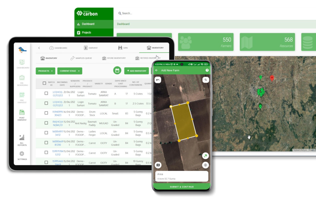
Digital tools driven by remote sensing and satellite technology offer a comprehensive approach to monitoring and managing the environment. These tools harness data from satellites, providing a wealth of information for tasks like land cover analysis, climate monitoring, and ecological assessments.
The advantages of employing digital monitoring tools are multifaceted. They enable real-time data acquisition, enhancing the accuracy of measurements crucial for carbon sequestration efforts. Additionally, these tools facilitate efficient large-scale monitoring, reducing the need for extensive fieldwork. The ability to analyze trends over time and detect changes promptly contributes to more effective decision-making in environmental conservation.
Numerous case studies illustrate the effectiveness of digital tools in carbon sequestration projects. For instance, satellite-based monitoring has proven instrumental in tracking reforestation progress, ensuring optimal carbon storage. In another context, these tools assist in identifying degraded areas suitable for restoration, maximizing the impact of carbon offset initiatives. Such examples highlight the pivotal role that digital tools play in advancing the precision, scalability, and success of carbon sequestration projects on a global scale.
Geospatial technologies play a crucial role in carbon measurement by providing accurate and spatially explicit data. From satellite imagery to Geographic Information Systems (GIS), these tools enable precise monitoring of carbon stocks, changes in land cover, and emissions sources, offering a comprehensive understanding of the carbon cycle.
The integration of geospatial data in environmental monitoring enhances the depth and breadth of information available. GIS, for example, allows the overlay of various spatial datasets, facilitating a holistic view of environmental factors influencing carbon dynamics. This integration aids in identifying high-priority areas for conservation, understanding ecosystem interactions, and formulating targeted strategies for emissions reduction.
Numerous success stories showcase the impact of projects leveraging geospatial technologies for emissions reduction. Satellite-based monitoring has been pivotal in tracking deforestation patterns, enabling proactive measures to combat illegal logging and promote sustainable land management. GIS applications have supported urban planning initiatives, optimizing transportation systems and reducing carbon footprints. These success stories underline the transformative potential of geospatial technologies in achieving tangible outcomes in the ongoing global effort to mitigate climate change and reduce carbon emissions.
Utilizing remote sensing enables precise and effective classification and mapping of land cover. Through the analysis of satellite imagery, the identification of various land cover types, including forests, agricultural lands, water bodies, and urban areas, becomes achievable. This valuable information contributes to monitoring shifts in land use patterns, identifying deforestation, and formulating strategies for sustainable land management practices.
Remote sensing enables the evaluation of forest health through the analysis of indicators like vegetation indices, canopy density, and forest structure. Monitoring changes in these parameters aids in detecting signs of diseases, pests, and stress factors impacting overall forest health. Timely detection facilitates proactive measures to mitigate potential threats, preserving the balance of forest ecosystems.
The application of remote sensing in agriculture is extensive, aiding in the monitoring of crop health, optimizing irrigation, and improving yield predictions. Through the analysis of satellite imagery and vegetation indices, farmers and researchers can pinpoint areas of stress, nutrient deficiencies, and disease outbreaks in crops. This allows for targeted interventions, efficient resource allocation, and the promotion of sustainable farming practices
Comprehending the effects of climate change is vital for formulating successful mitigation and adaptation strategies. Remote sensing supplies valuable data on essential climate variables like temperature, precipitation, and vegetation dynamics. Through continuous monitoring, scientists can analyze trends, model climate scenarios, and evaluate the impact of climate change on ecosystems and vulnerable areas.
Verifying carbon sequestration efforts presents challenges due to the need for accurate and transparent measurement. Issues such as data reliability, consistency, and the complexity of tracking changes in carbon stocks over time can impede effective verification, impacting the credibility of carbon offset projects.
Remote sensing significantly aids in overcoming these challenges by providing a non-invasive, large-scale approach to monitoring carbon dynamics. Satellite technology allows for regular and consistent data acquisition, offering a continuous assessment of vegetation cover, land-use changes, and carbon storage. This enables more precise and reliable verification of carbon sequestration efforts.
Real-world examples highlight successful carbon sequestration verification using remote sensing technology. For instance, projects in afforestation and reforestation leverage satellite imagery to monitor tree growth and assess carbon accumulation over designated periods. The use of LiDAR technology enhances accuracy in measuring above-ground biomass, contributing to robust verification processes. These examples demonstrate the pivotal role of remote sensing in ensuring the transparency and effectiveness of carbon sequestration initiatives, ultimately supporting the global commitment to mitigating climate change.
Tracking and monitoring emissions reduction initiatives is crucial for assessing progress in mitigating climate change. It involves continuously measuring greenhouse gas emissions evaluating the effectiveness of reduction strategies, and adapting approaches as needed to meet environmental goals.
Satellite technology offers real-time emissions tracking by capturing data on various pollutants from space. Satellites equipped with specialized sensors can monitor sources of emissions such as industrial facilities, wildfires, and transportation. This capability enhances the ability to identify and address emission hotspots promptly.
Innovations in digital tools for emissions reduction measurement encompass advanced technologies like Artificial Intelligence (AI) and Internet of Things (IoT). AI models can analyze complex datasets to identify patterns and optimize emission reduction strategies. IoT devices provide on-the-ground real-time data, contributing to a comprehensive understanding of emissions sources and facilitating targeted interventions. These digital tools foster a more dynamic and adaptive approach to emissions reduction, leveraging technology to enhance precision and efficiency in achieving environmental sustainability goals.
Remote sensing has revolutionized environmental monitoring, providing invaluable global-scale data for applications ranging from land cover classification to disaster management and biodiversity conservation. This versatile technology empowers us to make informed decisions, implement sustainable practices, and safeguard our planet’s delicate ecosystems.

A highly positive aspect of environmental monitoring through remote sensing is the availability of numerous active satellite missions that offer data and images with diverse characteristics, spatial resolutions, spectral capabilities, and temporal resolutions. Notable missions in this regard include Landsat by NASA, Sentinel by the European Space Agency (ESA), and CBERS, a collaborative effort between Brazil and China. These missions openly provide historical image series in standardized georeferenced formats, making them readily accessible for end-users. Resources such as Google Earth Engine (GEE) also provide easy access to vast global datasets.
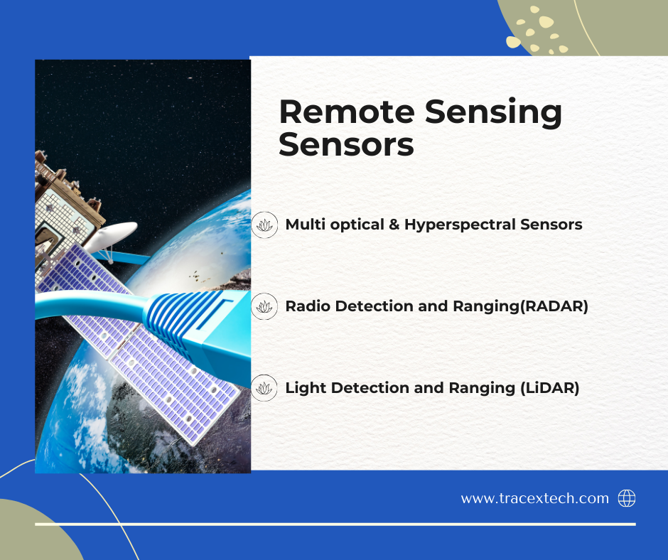
Another significant factor is the growing availability of a diverse range of sensors, each with distinct characteristics. This diversity enables the collection of various types of data and images, broadening the scope of applications for environmental monitoring. The chart below outlines the main types of sensors, their characteristics, and their applications in environmental monitoring:
In conclusion, the integration of remote sensing, satellite technology, and digital tools has become pivotal in addressing environmental challenges, particularly in carbon sequestration and emissions reduction efforts. These technologies offer a broad perspective, enabling accurate monitoring and verification crucial for sustainable practices. Challenges in verifying carbon sequestration efforts are being addressed through the continuous advancements in remote sensing, providing transparent and reliable data.
Satellite technology, with its real-time tracking capabilities, plays a central role in emissions monitoring, offering a global view of sources and trends. The synergy between geospatial technologies and environmental initiatives enhances our understanding of carbon dynamics, contributing to effective decision-making in conservation and resource management.
Innovations in digital tools, driven by AI and IoT, further amplify our capacity to measure and reduce emissions. Real-world examples demonstrate the success of projects leveraging these technologies, showcasing their transformative impact on the global commitment to combating climate change.
As we navigate the complex landscape of environmental stewardship, these technologies continue to evolve, offering promise in achieving a sustainable future. Their role in shaping policies, guiding interventions, and fostering global collaboration underscores their significance in the ongoing efforts to address climate change and build a resilient planet.
